Mapping Vocabulary
Aerial - a view from above
Altitude - how high something is
Area - an amount of space that has an outside limit or border
City- an area where a large amount of people have settled very closely together, usually has a business district and some form of self-government
Compass Rose - found on a map, a tool used to show north, south, west and east
Continent - one of the 7 large landmasses of the world
Coordinates - the set of two latitude and longitude numbers that gives an exact location
Country - an area that has a government and its own identity
Degree - unit of measurement used to tell latitude/longitude and also used to tell temperature
Direction- which way you go, such as left, right, north, south
Distance- how far you go to reach your destination
East - one of the 4 main direction points of a compass
Elevation - the distance of something above a certain point
Equator - a line of latitude that is at 0 degrees
Globe - a small scale, rounded representation of the world
Global Positioning System (GPS) - a tool using computer and satellite that helps navigate an area and find a specific place by using its latitude and longitude
Key / Legend - an area on a map that has small symbols and descriptions to explain what items on the map mean
Landforms- a unique feature on the surface of the earth
Latitude - the imaginary lines that go across the world and divide the globe into north and south
Location - where something can be found
Longitude - the imaginary lines that go up and down and divide the globe into west and east
Map - a small scale, flat, representation of the world
Map Types - see physical, political and thematic maps
North - one of the 4 main direction points of a compass
Ocean - the 5 large bodies of saltwater
Parallels - lines that are beside each other but will never touch
Physical Map - a map that shows all the landforms and surface features
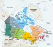
Political Map - a map that shows all the country borders, cities and administrative areas
Position - where something is located often used to help explain where something is in relation to somewhere else
Projection - the representation or way something is shown depending on what angle or perspective it is being shown from
Ratio - a comparison of two things
Scale - a tool used to show actual size or distance
Sea level - where the ocean's surface is, used as a measuring point for elevation
South - one of the 4 main direction points of a compass
Symbols - small pictures or representations of another visual
Thematic Map - a map that focused on a specific topic or issue
Time Zones - the 24 regions of the world that are created by lines of longitude
Topography - shows all the surface features on an area of land, this includes mountains, rivers, hills etc...
Tropic of Cancer - line of latitude 23.5 degrees north of the equator, this is where the sun shines directly overhead at noon on the solstice of June 21st (the beginning of summer in the Northern Hemisphere and the beginning of winter in the Southern Hemisphere), area to the equator "tropics" does not experience seasons as sun is always high in the sky
Tropic of Capricorn - line of latitude 23.5 degrees south of the equator, this is where the sun shines directly overhead at noon on the solstice of December 21 (the beginning of winter in the Northern Hemisphere and the beginning of summer in the Southern Hemisphere), area to the equator "tropics" does not experience seasons as sun is always high in the sky
West - one of the 4 main direction points of a compass
Altitude - how high something is
Area - an amount of space that has an outside limit or border
City- an area where a large amount of people have settled very closely together, usually has a business district and some form of self-government
Compass Rose - found on a map, a tool used to show north, south, west and east
Continent - one of the 7 large landmasses of the world
Coordinates - the set of two latitude and longitude numbers that gives an exact location
Country - an area that has a government and its own identity
Degree - unit of measurement used to tell latitude/longitude and also used to tell temperature
Direction- which way you go, such as left, right, north, south
Distance- how far you go to reach your destination
East - one of the 4 main direction points of a compass
Elevation - the distance of something above a certain point
Equator - a line of latitude that is at 0 degrees
Globe - a small scale, rounded representation of the world
Global Positioning System (GPS) - a tool using computer and satellite that helps navigate an area and find a specific place by using its latitude and longitude
Key / Legend - an area on a map that has small symbols and descriptions to explain what items on the map mean
Landforms- a unique feature on the surface of the earth
Latitude - the imaginary lines that go across the world and divide the globe into north and south
Location - where something can be found
Longitude - the imaginary lines that go up and down and divide the globe into west and east
Map - a small scale, flat, representation of the world
Map Types - see physical, political and thematic maps
North - one of the 4 main direction points of a compass
Ocean - the 5 large bodies of saltwater
Parallels - lines that are beside each other but will never touch
Physical Map - a map that shows all the landforms and surface features
Political Map - a map that shows all the country borders, cities and administrative areas
Position - where something is located often used to help explain where something is in relation to somewhere else
Projection - the representation or way something is shown depending on what angle or perspective it is being shown from
Ratio - a comparison of two things
Scale - a tool used to show actual size or distance
Sea level - where the ocean's surface is, used as a measuring point for elevation
South - one of the 4 main direction points of a compass
Symbols - small pictures or representations of another visual
Thematic Map - a map that focused on a specific topic or issue
Time Zones - the 24 regions of the world that are created by lines of longitude
Topography - shows all the surface features on an area of land, this includes mountains, rivers, hills etc...
Tropic of Cancer - line of latitude 23.5 degrees north of the equator, this is where the sun shines directly overhead at noon on the solstice of June 21st (the beginning of summer in the Northern Hemisphere and the beginning of winter in the Southern Hemisphere), area to the equator "tropics" does not experience seasons as sun is always high in the sky
Tropic of Capricorn - line of latitude 23.5 degrees south of the equator, this is where the sun shines directly overhead at noon on the solstice of December 21 (the beginning of winter in the Northern Hemisphere and the beginning of summer in the Southern Hemisphere), area to the equator "tropics" does not experience seasons as sun is always high in the sky
West - one of the 4 main direction points of a compass
Mapping Questions
Why are there different map projections?
What do time zones mean?
How do I find the exact location of a place?
Why is a legend / key useful?
What is the significance of the equator?
What is the purpose of the International Date Line?
What do time zones mean?
How do I find the exact location of a place?
Why is a legend / key useful?
What is the significance of the equator?
What is the purpose of the International Date Line?
Mapping Visual (picture) Dictionaries
1. Merriam Webster Visual Dictionary: http://visual.merriam-webster.com/earth/geography.php
2. Enchanted Learning (Ms. Fell adapted) Visual Dictionary:
2. Enchanted Learning (Ms. Fell adapted) Visual Dictionary:
